Introduction to Chronosequence:
Repeated photography of the same scene over seasons and years has long been used by artists and scientists to document landscape change. This technique is especially relevant after major scene-changing events, such as wildfire, volcanic eruptions, and human land use activities. For this project, we selected 25 distinct photopoints that represent different forest conditions. During the first three years we photographed each photopoint 17 times in order to record the changing landscape following the fire. Here is a sampling of the most interesting changes. Note the abundance of vegetation, its changes over seasons and years, the collapse of dead and living trees, and signs of the uncertain future – climate change, invasive species, and intensive forestry. And note your own emotional responses as you view the changes in the land.
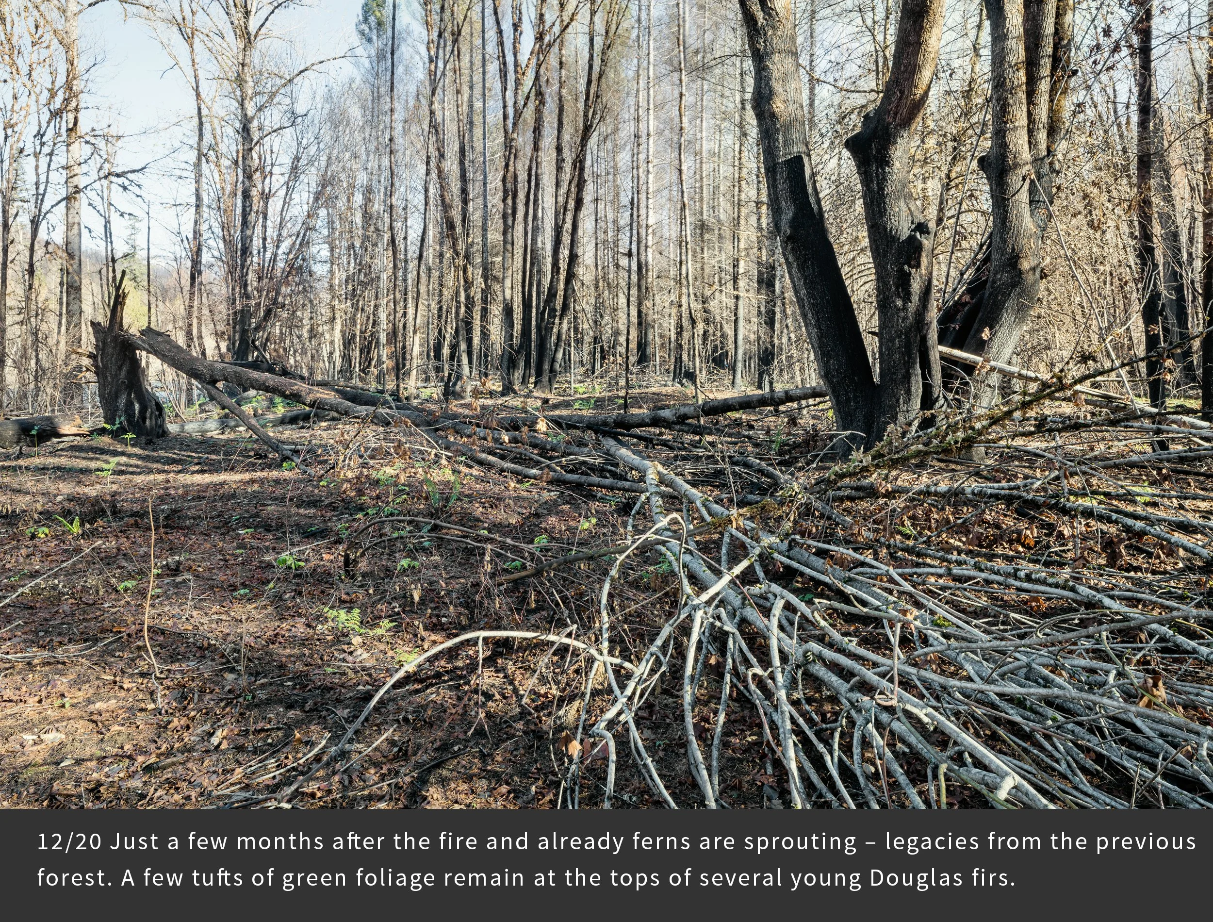
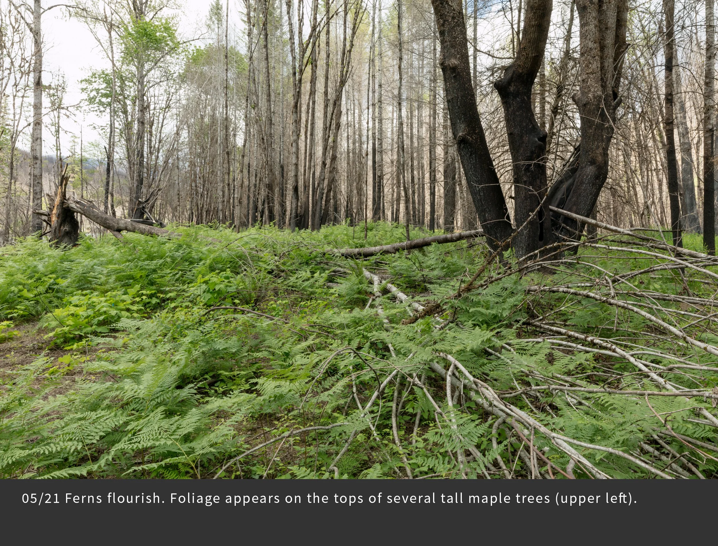
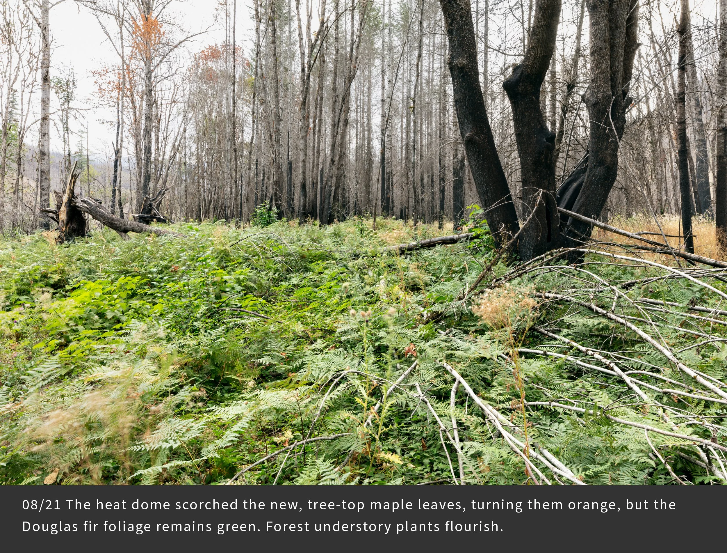
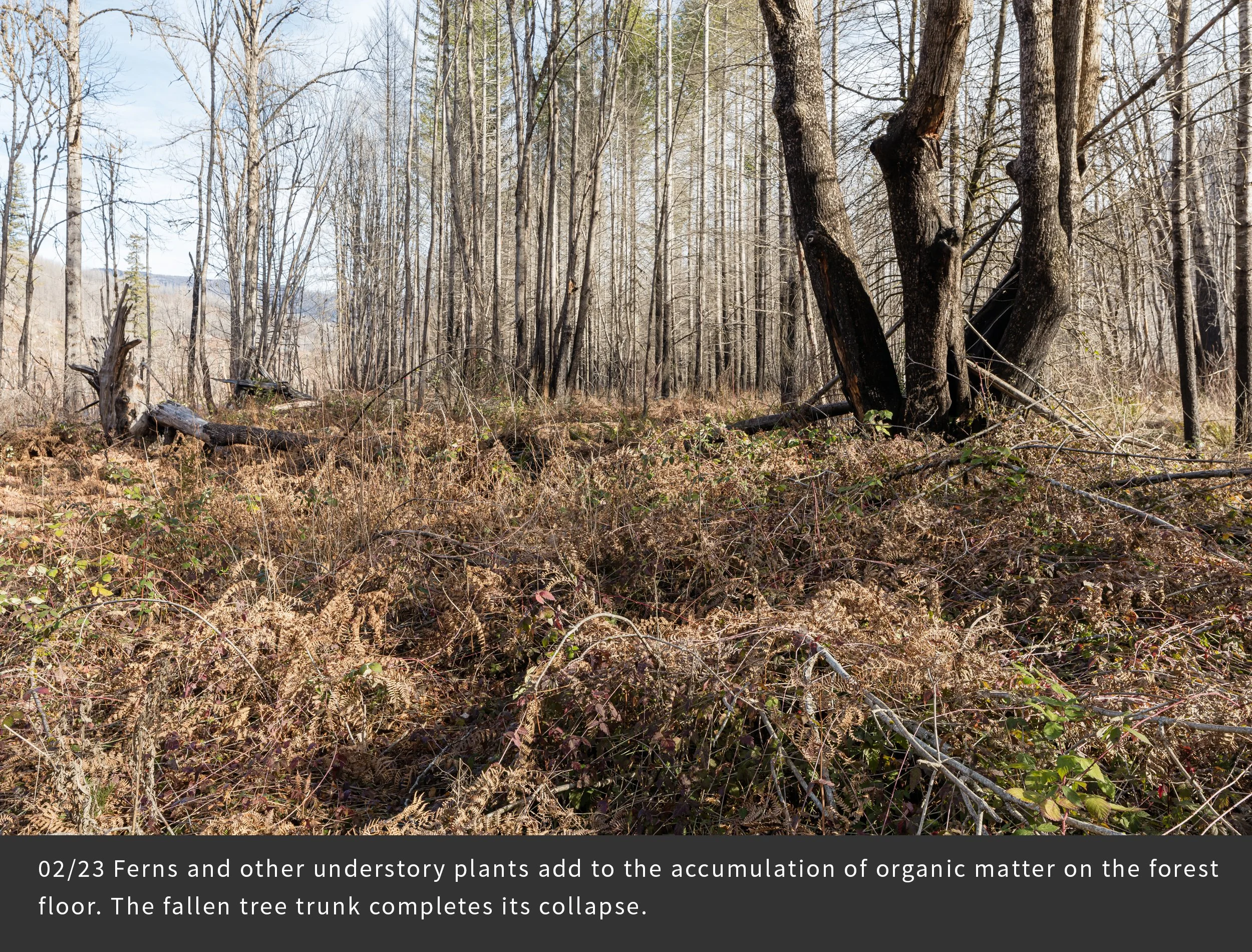
Photopoint FRR26
Two clusters of large trunks of bigleaf maples experience different fates in the fire: the one on the right remains standing, while the one on the left suffered smoldering fire in its core, leading to collapse of the trunks. One trunk and its tree top fell to the ground at our feet. Lack of charring of this tree top suggests it fell after the ground fire swept through the area. The unexpected heat dome of late June 2021 damaged the vulnerable, early-season foliage of the hardwoods, perhaps a sign of climate change effects to come. An especially concerning aspect of the uncertain future is the increasing frequency and severity of fire in the region over the past decade.