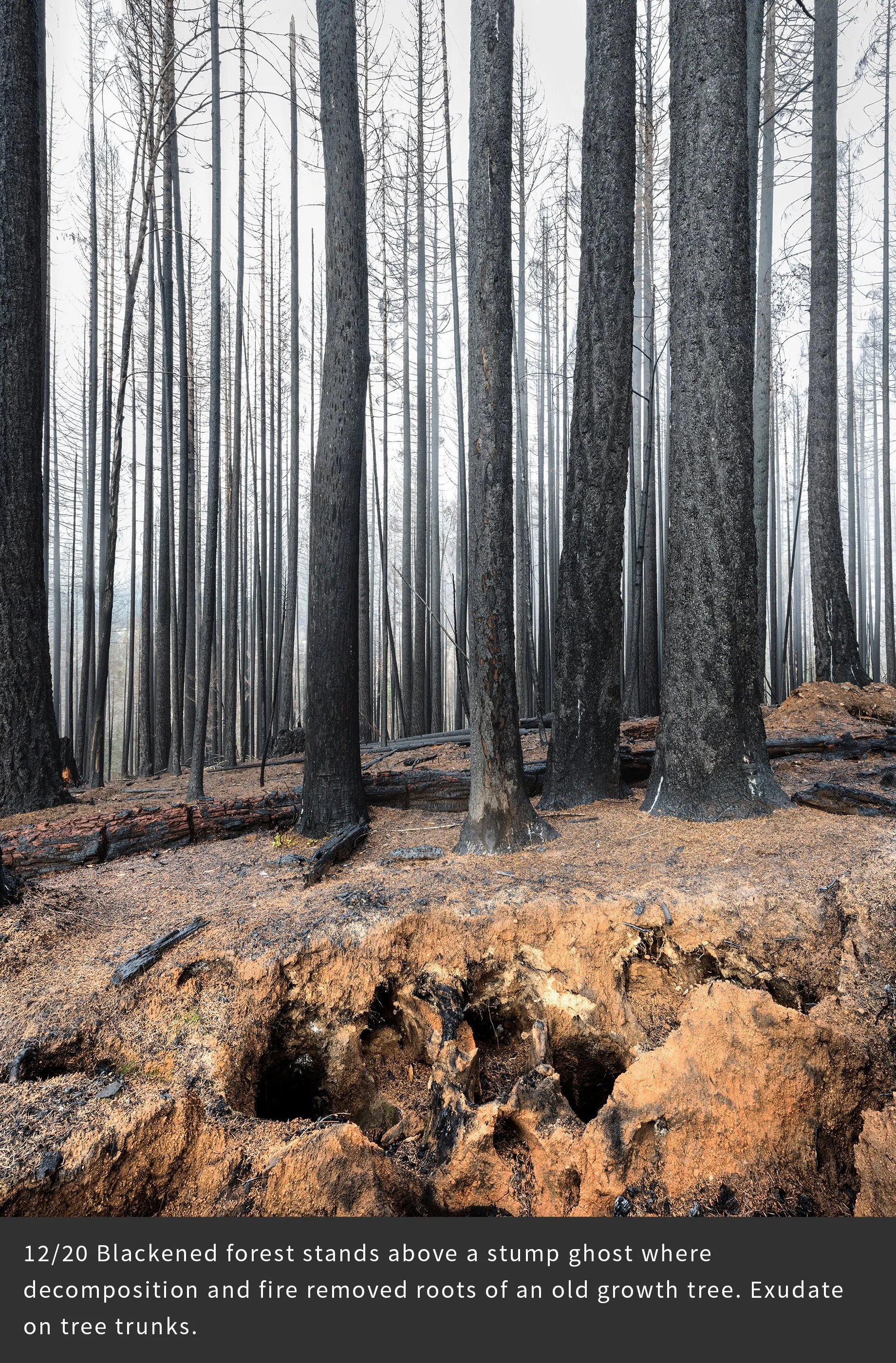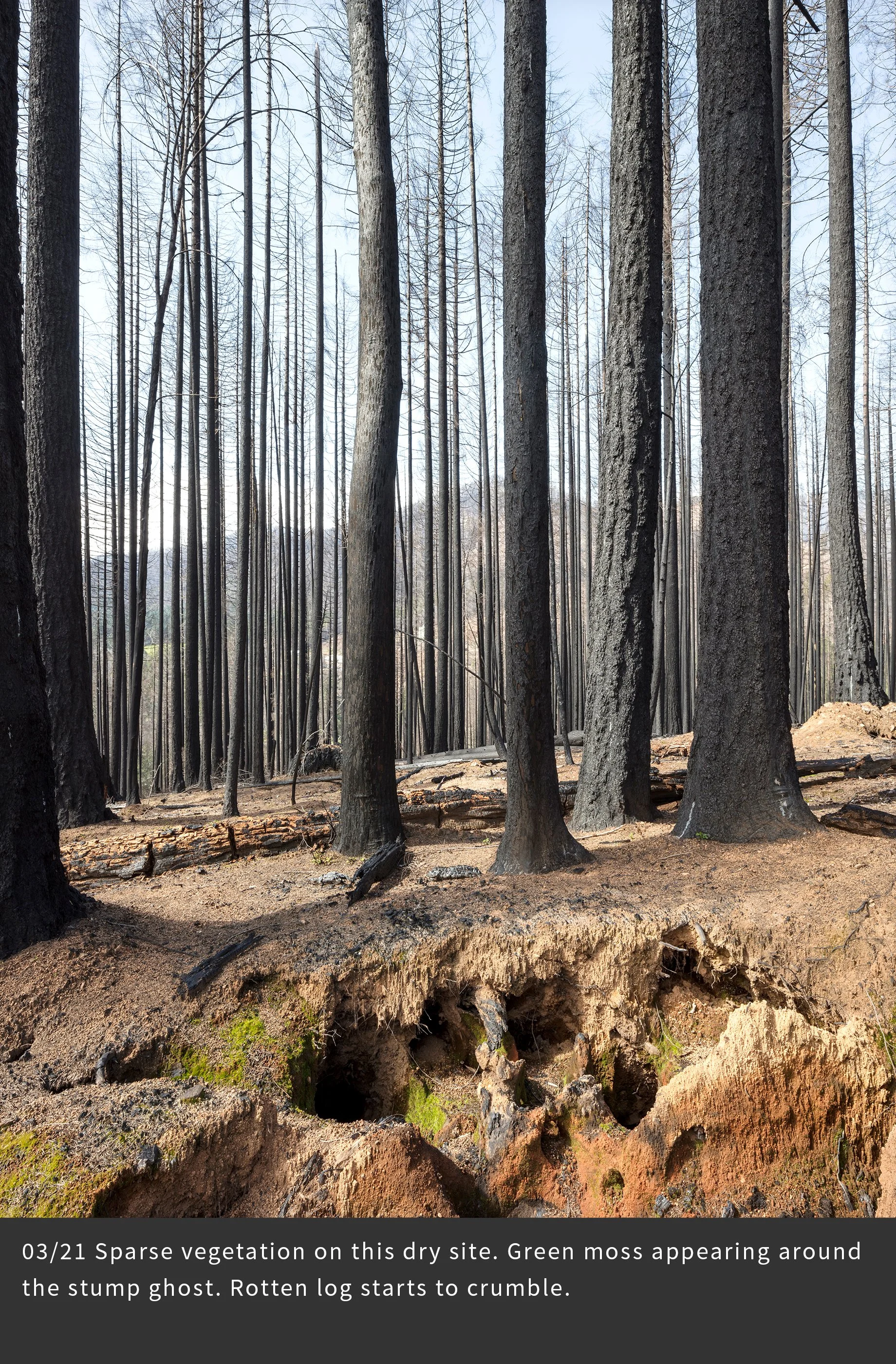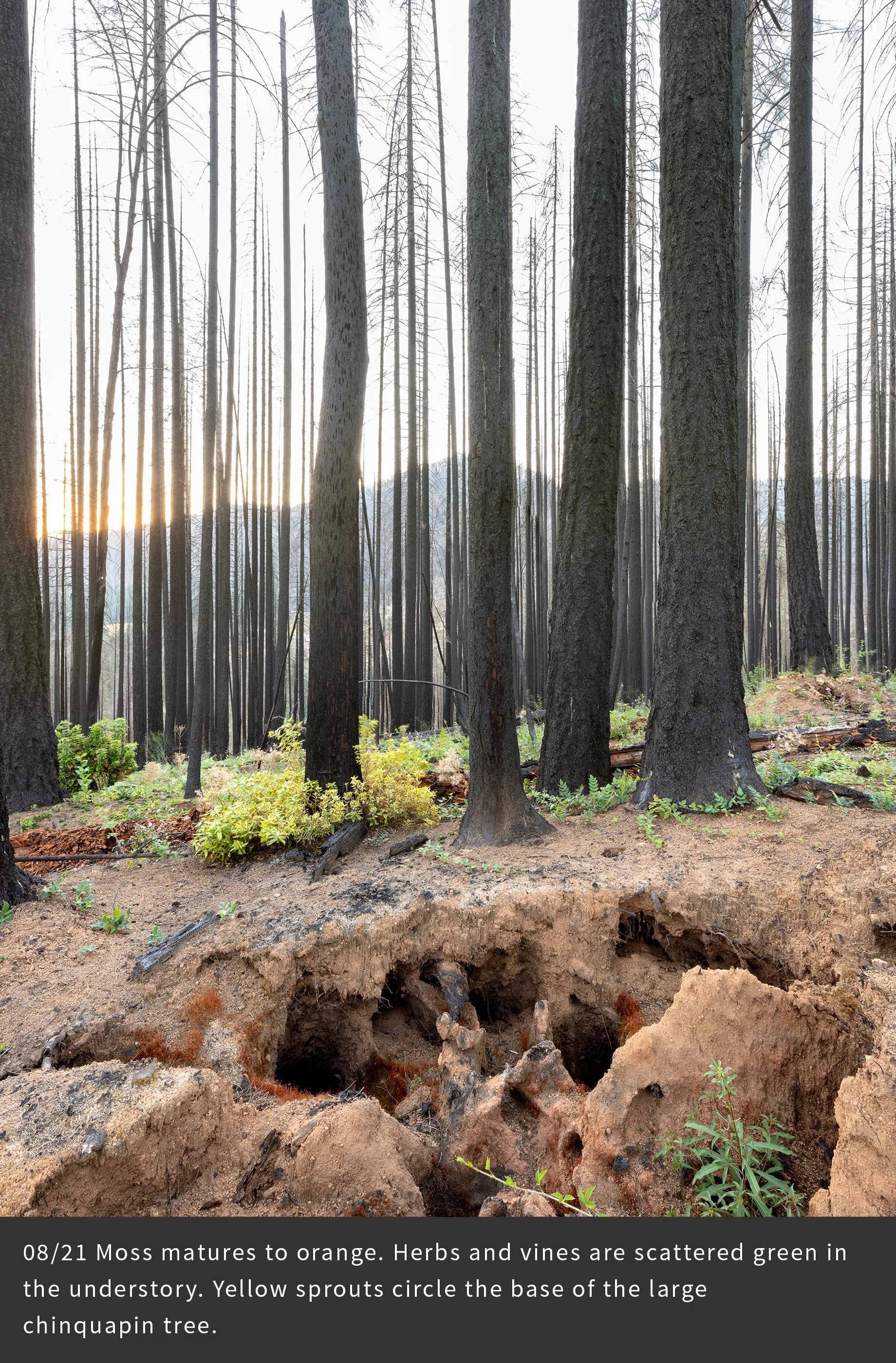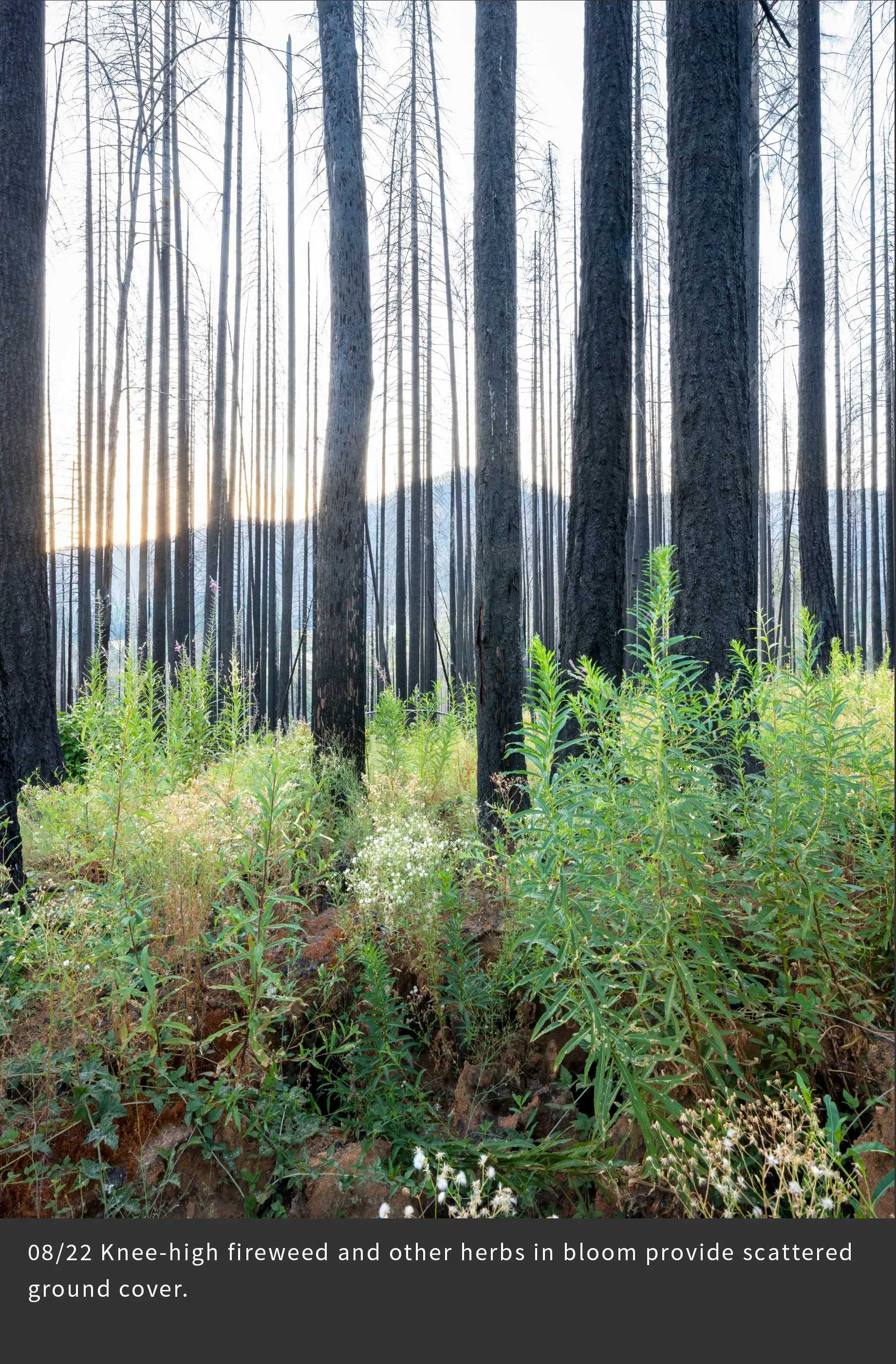
Introduction to Chronosequence:
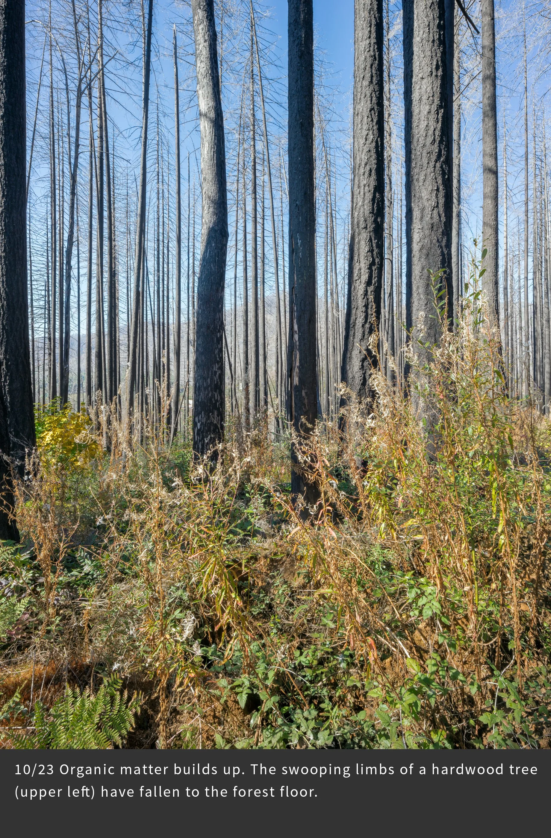
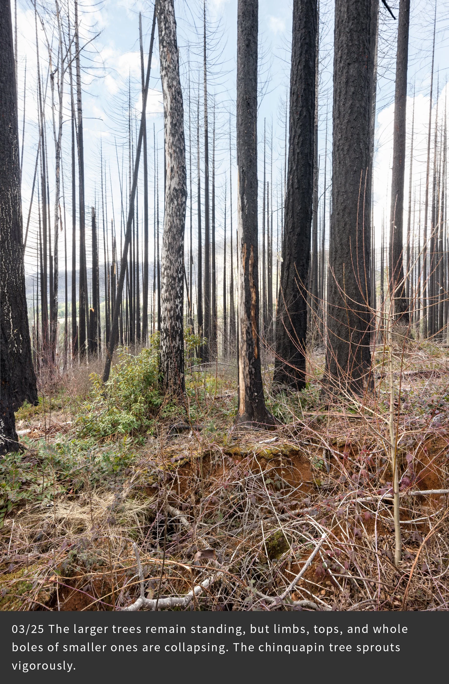
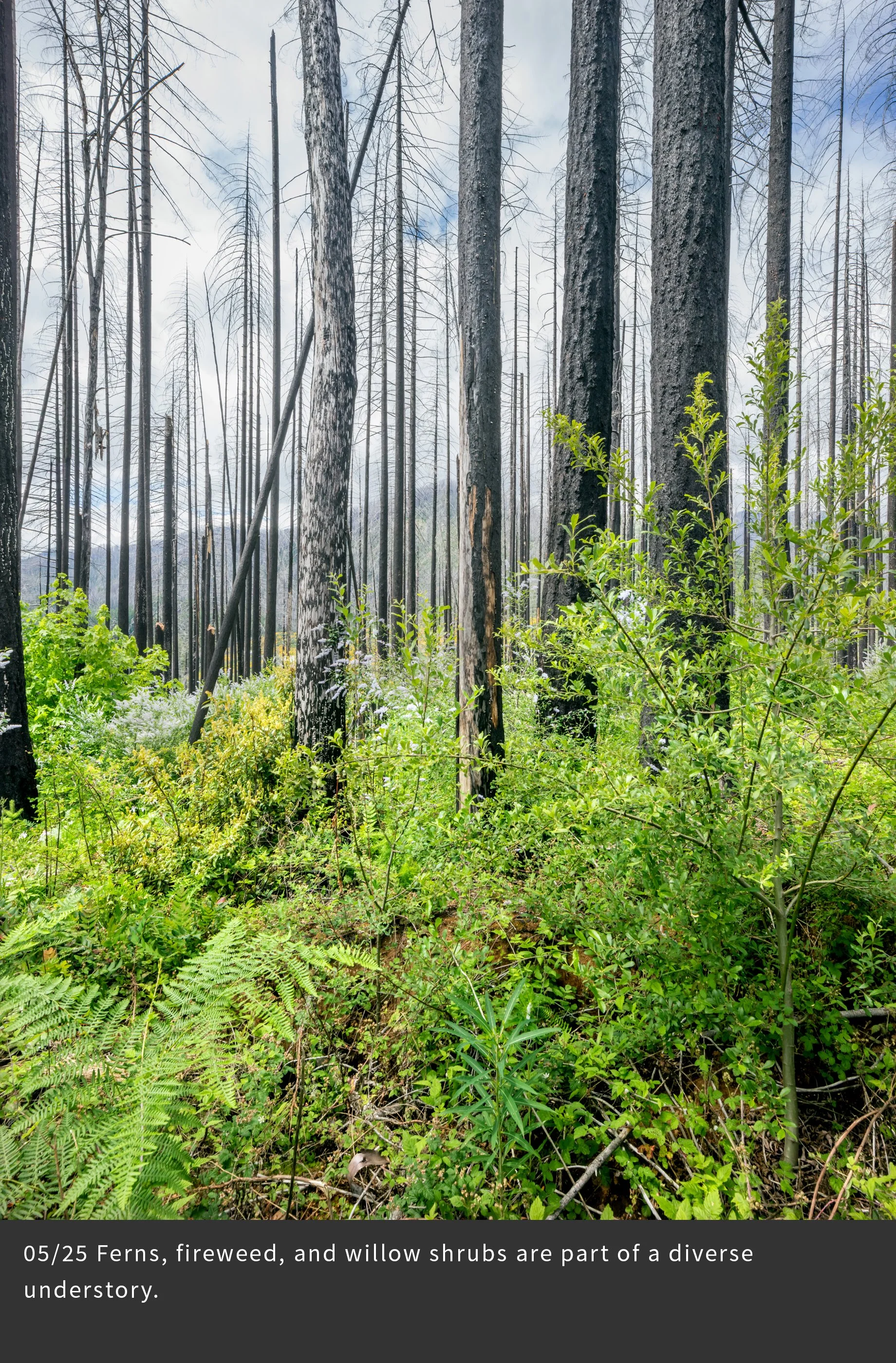
Repeated photography of the same scene over seasons and years has long been used by artists and scientists to document landscape change. This technique is especially relevant after major scene-changing events, such as wildfire, volcanic eruptions, and human land use activities. For this project, we selected 25 distinct photopoints that represent different forest conditions. During the first three years we photographed each photopoint 17 times in order to record the changing landscape following the fire. Here is a sampling of the most interesting changes. Note the abundance of vegetation, its changes over seasons and years, the collapse of dead and living trees, and signs of the uncertain future – climate change, invasive species, and intensive forestry. And note your own emotional responses as you view the changes in the land.
Photopoint BRCE04
This site above the town of Blue River is dryer than the river-side Finn Rock Reach site, where many of the other chronosequence sites are located, hence vegetation development is slower here. Several age classes of trees, mainly Douglas fir, established after logging and fires over the past century. A massive stump ghost – a cavity in the ground left by decomposition and burning of an old growth root system – and a decomposing log are evidence of the old forest that formerly occupied this place. This photopoint was selected for its aesthetic qualities.