


Your Custom Text Here
INTRODUCTION Finn Rock Reach and Blue River Conservation Easement
Our two project sites, Finn Rock Reach and Blue River Conservation Easement, are just a few miles from each other along the McKenzie River on the wet, west side of the Cascade Range in central Oregon. The forest has a very long history of fire and regeneration, characterized by a mixture of low-severity / high-severity burning. While this project looks at many forest fire details specific to this region, the general perspective of addressing forest resilience and the uncertain future is useful anywhere that forests and fire coexist.
Blue River Conservation Easement
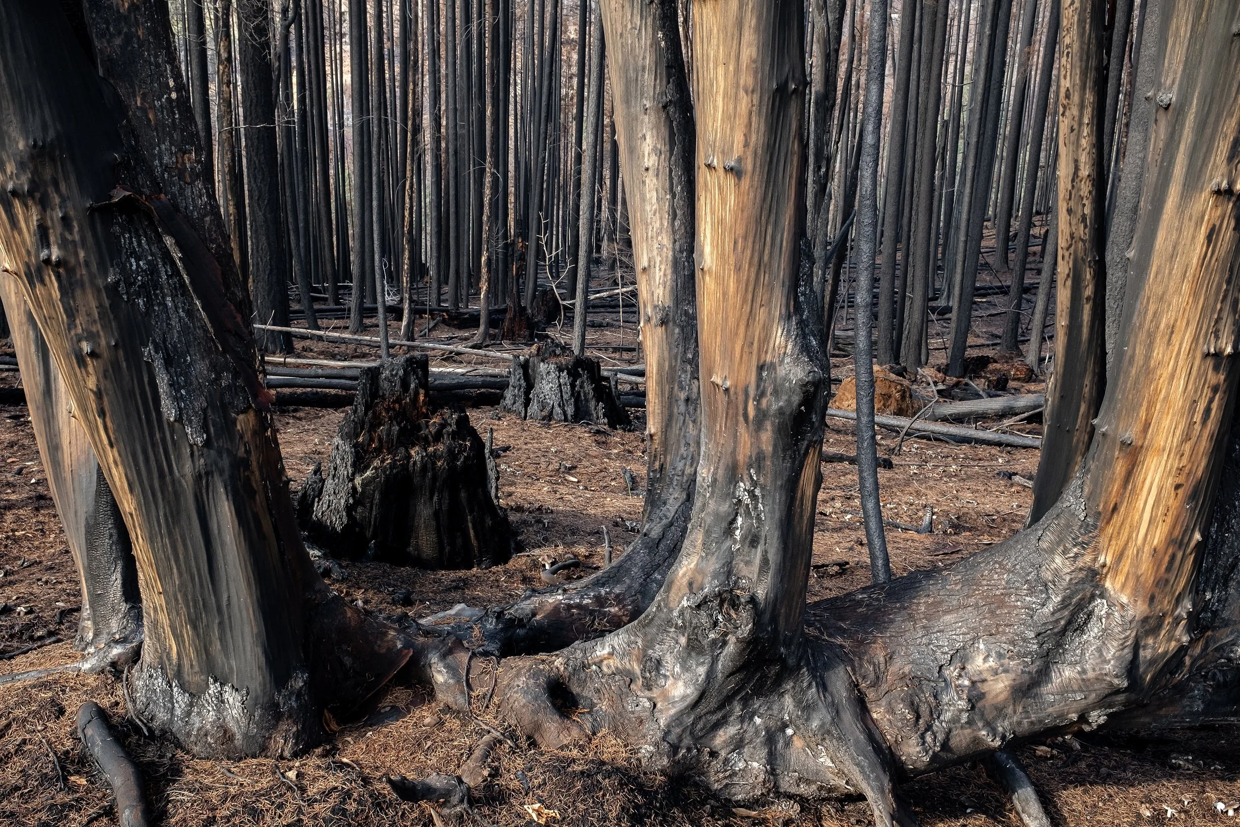
The drier, upland Blue River Conservation Easement site contains Douglas fir of several post-fire age classes and bigleaf maples with their knobby stems revealed after burning prompted them to shed their bark. Here, too, remnants of an earlier, old forest are evident in the cut, but highly decomposed stumps.
Fireweed, fire moss, and other plant life emerged over the first post-fire year, but at a slower pace than in the more moist Finn Rock Reach site. The dry conditions here probably also contributed to greater mortality of trees. At this site no trees survived. Even so, most of the carbon and nutrient stocks from before the fire were retained in the trees, downed logs, and below ground.
Fortuitously, a patch of forest photographed several times after the fire was clearcut, giving us the opportunity to compare forest response to fire with and without “salvage” logging. Various forms of land use, including further logging and planting of tree seedlings, are part of the forest’s uncertain future. Will past cycles of clearcutting followed by the 2020 fire and future clearcutting diminish the lands’ ability to sustain this forest in the future?
INTRODUCTION Finn Rock Reach and Blue River Conservation Easement
Our two project sites, Finn Rock Reach and Blue River Conservation Easement, are just a few miles from each other along the McKenzie River on the wet, west side of the Cascade Range in central Oregon. The forest has a very long history of fire and regeneration, characterized by a mixture of low-severity / high-severity burning. While this project looks at many forest fire details specific to this region, the general perspective of addressing forest resilience and the uncertain future is useful anywhere that forests and fire coexist.
Blue River Conservation Easement
The drier, upland Blue River Conservation Easement site contains Douglas fir of several post-fire age classes and bigleaf maples with their knobby stems revealed after burning prompted them to shed their bark. Here, too, remnants of an earlier, old forest are evident in the cut, but highly decomposed stumps.
Fireweed, fire moss, and other plant life emerged over the first post-fire year, but at a slower pace than in the more moist Finn Rock Reach site. The dry conditions here probably also contributed to greater mortality of trees. At this site no trees survived. Even so, most of the carbon and nutrient stocks from before the fire were retained in the trees, downed logs, and below ground.
Fortuitously, a patch of forest photographed several times after the fire was clearcut, giving us the opportunity to compare forest response to fire with and without “salvage” logging. Various forms of land use, including further logging and planting of tree seedlings, are part of the forest’s uncertain future. Will past cycles of clearcutting followed by the 2020 fire and future clearcutting diminish the lands’ ability to sustain this forest in the future?